Here you can find information about what is new in Carbon Compass version 1.2.12 (after 1.1.13).
Public Features
The functionality described in this section is available to users.
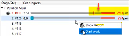
Additional Protection of Overcut and Allowance Area
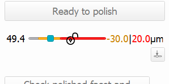
To additionally protect the overcut and allowance area, the dynamic "lock" icon is now displayed when a user hovers the mouse over the overcut/allowance zone. Also, the zones are drawn in grey-yellow, grey-red colors correspondingly. The slider cannot be moved into a locked area.
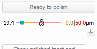
If the user clicks this icon, the zones become unlocked, their color changes to bright-yellow, bright-red, the icon changes to unlocked lock, and the slider can be moved into both zones.
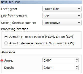
Slope Allowance Parameter
In the Next Step Plans panel, the Allowance section, the Angle parameter is renamed to Slope. The usage of the parameter is temporarily blocked (next step calculation does not consider this parameter) due to technical reasons (planned to be restored in the upcoming releases).
| Was | Now |
|---|---|
|
|
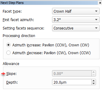
The Slope and Depth default values are now taken from the configuration file (saved there on user input in the corresponding fields).
For the Table, the default values are always "0".
Fixed Problems and Improvements
The following fixes for the known problems and improvements are implemented:
- The actual cut model weight is updated now when the actual cut changes.
- On step completion, the Overcut zone (red) shifted to the actual cut marker - now it is fixed, and the zone stays unchanged.
- For the
 Edit contour tool, the text labels were duplicated - now it is fixed.
Lexus Private Details
The information in this section is for sharing with Lexus only.
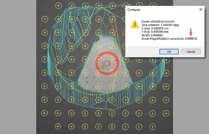
GPS Camera Calibration - Zoom Factor
Previously a GPS camera calibration was done manually by selecting the coefficient - now the automated procedure via the calibration grid is implemented.
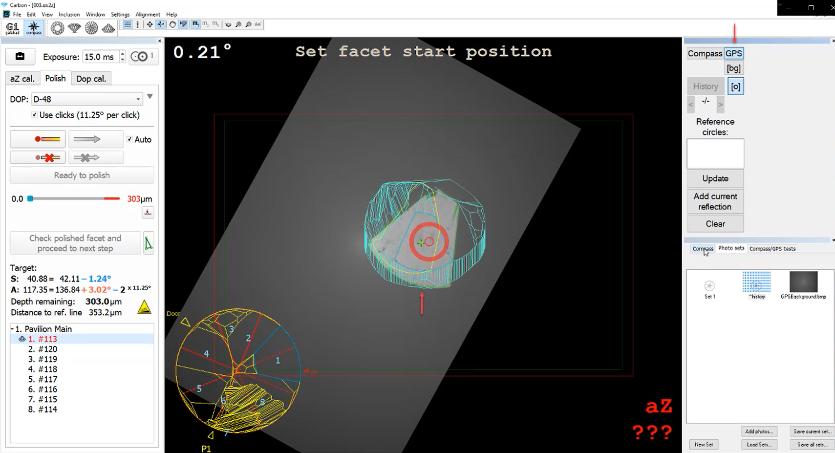
To calibrate a GPS camera:
- Make a photo of the background.
- Install the calibration grid and make its photo.
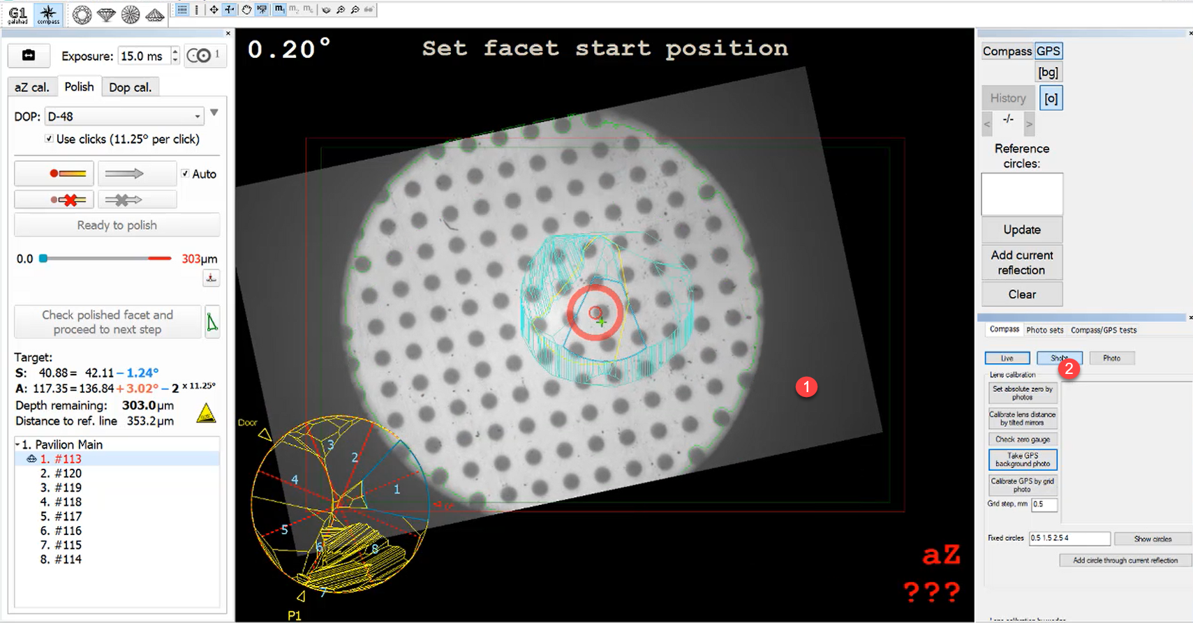
- On the right panel, the Compass tab, click Calibrate GPS by grid photo. The coordinates of the grid are found, 2D transform and zoom factor ("Zoom Magnification correction") is calculated.
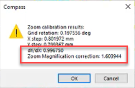
Now the image is matching in scale and during the next calibrations the zoom factor is not changed:
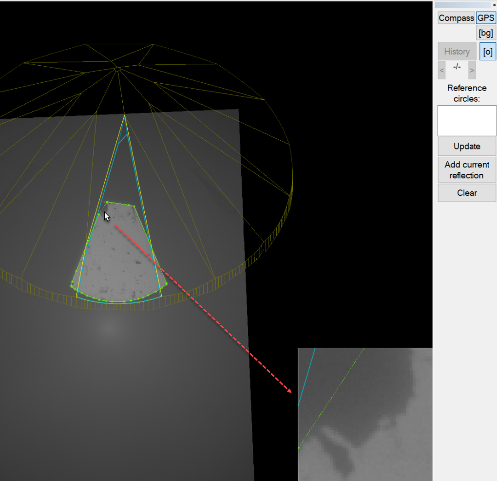
Manual Contour Correction - Magnifier
This functionality is available only for GPS.
Now in the Manual Contour Correction mode (activates on clicking on the left panel the Edit contour button), to make editing more comfortable and precise, the Magnifier is displayed in the right bottom corner of the Scene.
Fixed Problems and Improvements
The following fixes for the known problems and improvements are implemented:
Whenever a user finished the facet with a safety margin and started the next facet, then in the earlier facet, the stop cursor moved beyond the stop limit which was confusing - now this is fixed, the stop cursor remains in the position after finishing the facet.
- Faceting substep workflow was broken - now it is fixed.
- Allowance not left problem is fixed.
- Locked scrollbar moved beyond by mouse scroll wheel - now this is fixed.
- Two steps facet correction did not work - now it is fixed.
- Wrong facet depth after adding new stages is fixed.